Technology
ChironSoft does its best from the customer's perspective.
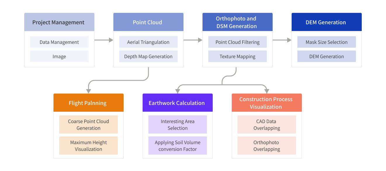
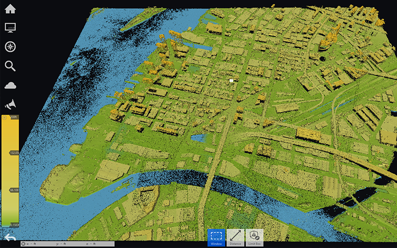
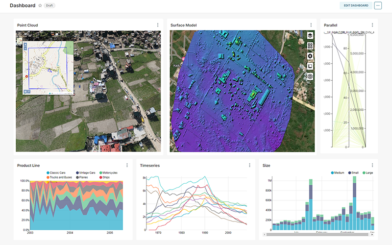
Produce, Manage, Analyze and Visualize orthophotos, point clouds, digital surface models (DSM), digital terrain models (DTM), and digital elevation models (DEM) as a variety of drone shooting results. Performance has been improved with GPU-based distributed processing technology.
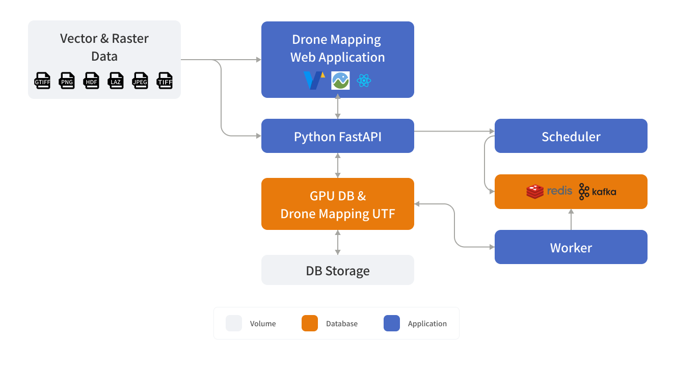
System Configuration
By combining data such as GPS and attitude values from videos and images acquired by drones and satellites, point clouds are created using surveying techniques, and orthoimages and digital surface models (DSM) are produced.
Calculation through low-density point cloud conversion is used again to create a digital elevation model (DEM). Based on this, we proceed with application architecture and system development.
Can be used to express elements of spatial data in various fields such as defense, construction, environmental monitoring, and agriculture, and analysis using artificial intelligence allows project stakeholders to understand and utilize the data.